About Stream Map USA - NE
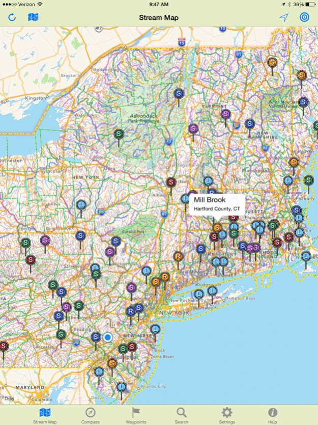
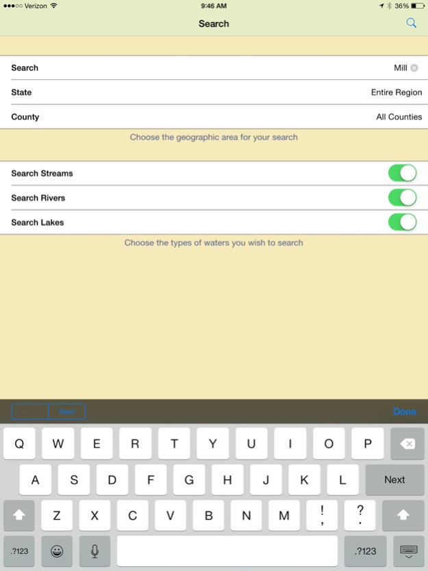
This color coded stream map lets you search any river, lake, or stream by state and county. Check nearby flow gauge data. Navigate right to the water's edge. Touch "Go" for instant driving directions. Travel along the...
This color coded stream map lets you search any river, lake, or stream by state and county. Check nearby flow gauge data. Navigate right to the water's edge.
Touch "Go" for instant driving directions. Travel along the stream with GPS tracking on topographic maps. Mark your favorite spots for your next trip.
Stream Map USA is a complete GPS mapping and navigation tool for anyone spending time on the nation's waterways. This edition covers the states of Maine, New Hampshire, Vermont, Connecticut, Massachusetts, Rhode Island, New York, New Jersey and Pennsylvania.
Stream Map USA features a searchable color coded map of America's rivers, lakes and streams that can be viewed on roadmaps, satellite images or topographic maps. As you travel, the map displays your location and tracks your progress even when there is no service. Both roadmaps and topographic maps can be stored on the phone for offline use.
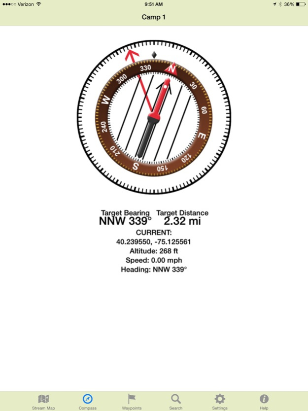
Custom waypoints provide navigation and allow you to plan your trip. Add a waypoint where you'll access the water, then tap "GO" for turn-by-turn driving directions right to that spot. Add additional waypoints for campsites, fishing holes, trailheads, equipment caches, pickup points and more. Now "Target" your next waypoint and the built-in compass points the direction and counts down the distance right to that destination.
When planning a trip on the water, it is always wise to know the water conditions in advance. As an added feature, Stream Map USA includes the ability to access real time stream gage and flow data for many streams and rivers.
No matter what activity you enjoy on the water, we're confident you'll find Stream Map USA a helpful addition.
Jan 26, 2020
Version 2.10
Updated for iOS-13. Fixes bug preventing stream gauge identification. Improves waypoint handling. Replaces waypoint flag markers with larger red pin markers for better visibility. Allows export and import or waypoints in CSV format for editing in other programs, apps or devices.
Previous Versions
Here you can find the changelog of Stream Map USA - NE since it was posted on our website on 2021-12-14 21:01:42.
The latest version is 2.10 and it was updated on 2024-04-22 11:58:02. See below the changes in each version.
Stream Map USA - NE version 2.10
Updated At: 2020-01-26
Changes: Jan 26, 2020 Version 2.10
Updated for iOS-13. Fixes bug preventing stream gauge identification. Improves waypoint handling. Replaces waypoint flag markers with larger red pin markers for better visibility. Allows export and import or waypoints in CSV format for editing in other programs, apps or devices.
Disclaimer
Official App Store Link
We do not host Stream Map USA - NE on our servers. We did not scan it for viruses, adware, spyware or other type of malware. This app is hosted by Apple and passed their terms and conditions to be listed there. We recommend caution when installing it.
The App Store link for Stream Map USA - NE is provided to you by apps112.com without any warranties, representations or guarantees of any kind, so access it at your own risk.
If you have questions regarding this particular app contact the publisher directly. For questions about the functionalities of apps112.com contact us.